The Picard ManeuverM to Cartography [email protected]English • 10 months agoDrawing the USA with an increasing number of edgeslemmy.worldimagemessage-square40fedilinkarrow-up1493
arrow-up1493imageDrawing the USA with an increasing number of edgeslemmy.worldThe Picard ManeuverM to Cartography [email protected]English • 10 months agomessage-square40fedilink
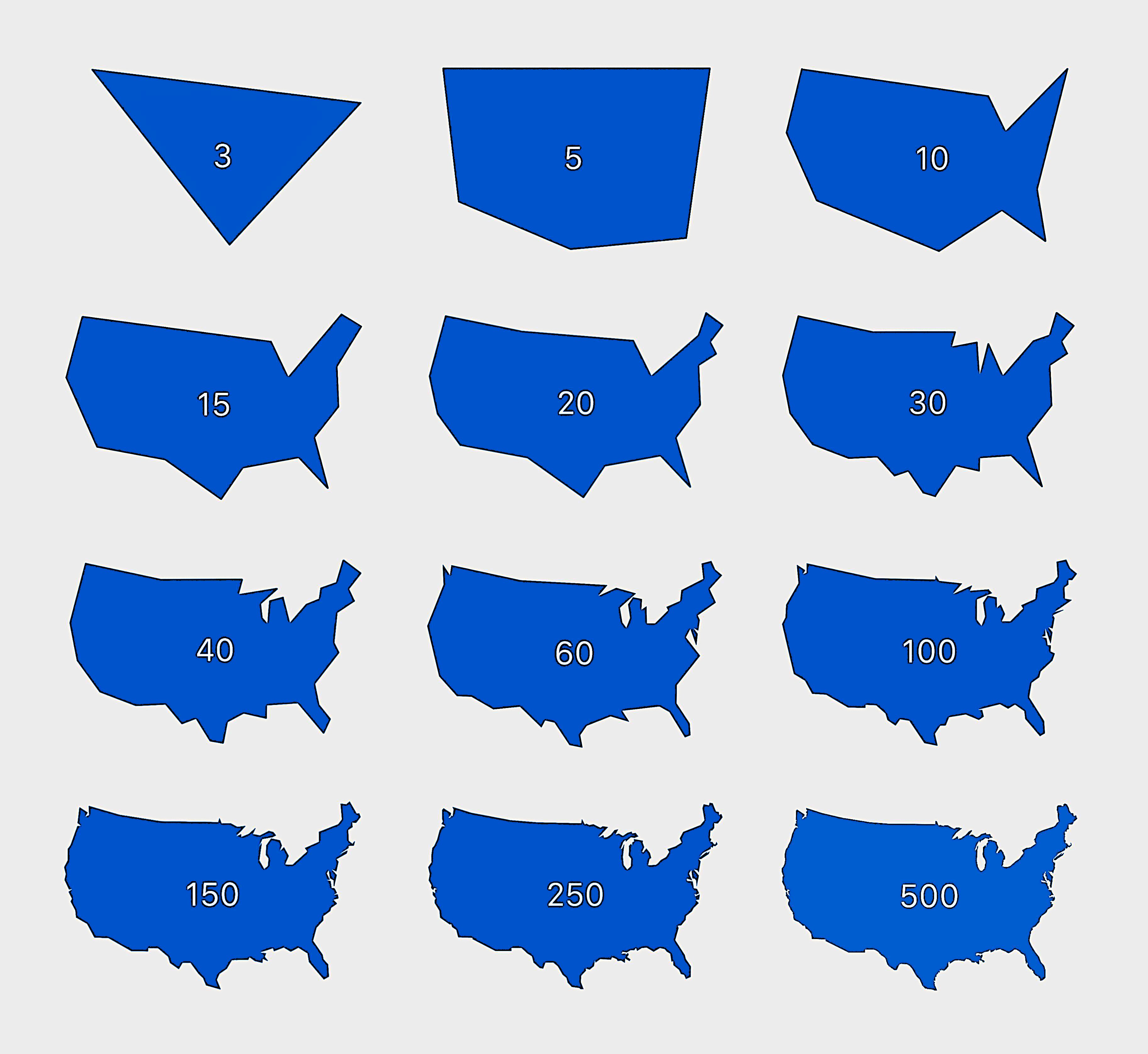
minus-square@[email protected]linkfedilinkEnglish30•10 months agoNot much of a distinguishable difference between 100 and 500. Pretty neat
minus-square@[email protected]linkfedilinkEnglish12•10 months agoThis is Michigan erasure and I will not stand for it.
minus-square@[email protected]linkfedilinkEnglish4•edit-210 months agoYup. At 10 I would get it after some number of fish related guesses - maybe just one. At 15 I’d instantly get it. Florida, Great Lakes, Texas; boom, America.
minus-square@[email protected]linkfedilinkEnglish1•8 months agoNot at this scale. It might matter more if you lived in a coastline

Not much of a distinguishable difference between 100 and 500. Pretty neat
10-15 is good enough. :)
This is Michigan erasure and I will not stand for it.
this is Michigan erasure and I’m all for it
the whale phase
Yup. At 10 I would get it after some number of fish related guesses - maybe just one. At 15 I’d instantly get it.
Florida, Great Lakes, Texas; boom, America.
Not at this scale. It might matter more if you lived in a coastline